 Using Google Earth for Remote Teaching | Tuesday, 16 June 2020, 11:00 AM MDT
Register
Presenters
Steve Whitmeyer, James Madison University
Andrew Laskowski, Montana State University
About this Webinar
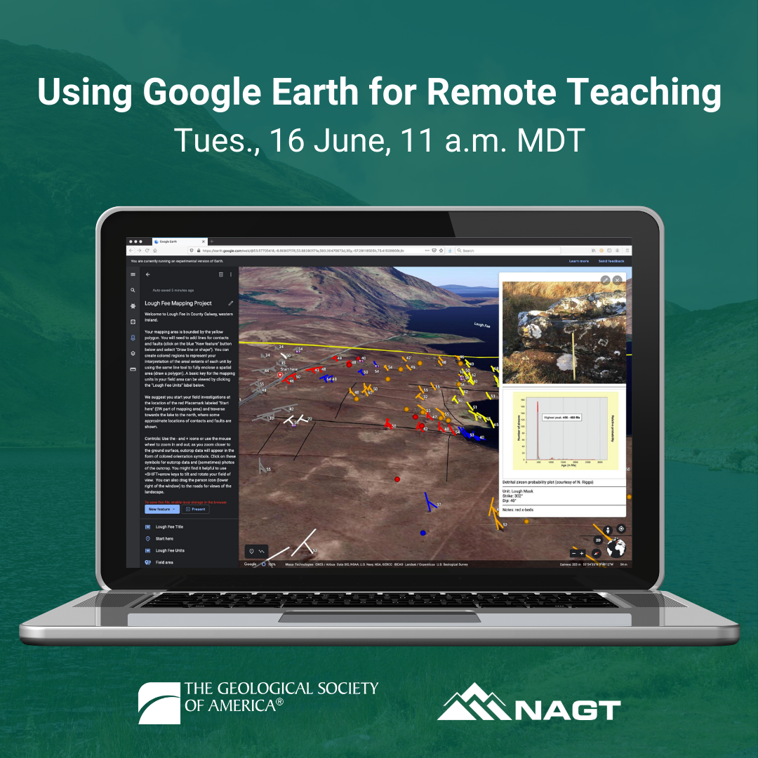
Google Earth is a powerful, but easy-to-use platform for virtually exploring natural features around the globe. The capability to create and share custom content for Google Earth has resulted in an abundance of presentations, exercises, and virtual field trips that are available to educators. This webinar will help you integrate Google Earth into remote Earth science courses by providing background on the tool and examples of its use in geoscience classes. In addition to the regular webinar overviewing Google Earth’s options, capabilities, and use cases, the presenters will do a follow up hands-on session two days later that will give participants a chance to work through some Google Earth activities themselves in a mentored (virtual) setting. This is a great opportunity to learn to use Google Earth the way your students would use it.
 Using Gigapan for Remote Teaching | Tuesday, 23 June 2020, 11:00 AM MDT
Register
Presenters
Callan Bentley, Northern Virginia Community College, Annandale Campus
Jennifer Piatek, Central Connecticut State University
About this Webinar
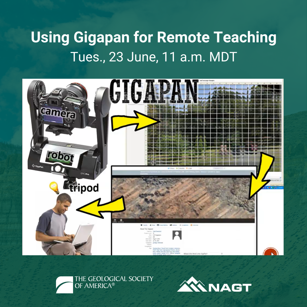
Gigapixel panoramas are high resolution 2D images that combine 'zoomed out' context with the power of 'zoomed in' details. Applied to teaching geology remotely, they are valuable web-based tools for exploring geoscience concepts with students at scales ranging from the landscape to the outcrop to hand samples, to thin sections, to SEM. GigaPans can be embedded in webpages or desktop-based Google Earth KML tours as elements in virtual field experiences, potentially gaining power when combined with DEMs, 3D models of outcrops or samples, 360° spherical photos, or video. They can also be used as 'virtual samples' in times when student access to samples is limited. This webinar will cover the technical side of producing your own GigaPan images via two hardware/software packages as well as how to deploy extant CC-licensed GigaPans in your own remote teaching and outreach.
 Using Virtual Landscapes for Remote Teaching | Tuesday, 30 June 2020, 11:00 AM MDT
Register
Presenters
Jacqueline Houghton, University of Leeds
Mark Helper, University of Texas at Austin
About this Webinar
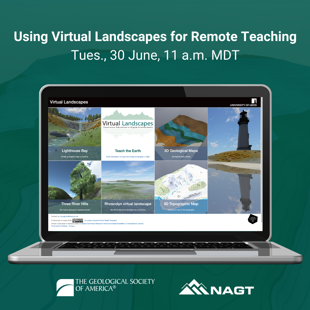
The Virtual Landscapes Project (https://www.see.leeds.ac.uk/virtual-landscapes/) uses the Unity 3D game engine to create screen based simulations of real and imagined landscapes, and interactive 3D block models of geologic and topographic maps. It aims to enhance the training students receive in geological field and map skills, and to develop 3D visualization skills. This webinar demonstrates how virtual landscapes can be used in the online geoscience classroom to recreate aspects of geologic mapping training and augment understanding of how rock units are represented on geologic maps. In addition to the regular webinar looking at the uses of the Virtual Landscapes, the presenters will do a follow up hands-on session two days later that will give participants a chance to explore the different virtual landscapes and their potential uses for themselves in a mentored (virtual) setting. This is a great opportunity to explore the Virtual Landscapes the way your students would experience them.